Top

Google Maps the Caribbean. So What’s Next? Use It!

November 13, 2007

scgooglecarib.JPG

by Suzette Gardner

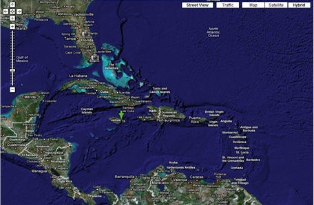
Small towns hardly make big news in the world of online marketing technology; small islands even less so. While most of us have gotten over Google putting small town America on the map—in the most literal of ways, the Caribbean is just getting around to celebrating our inclusion. Cuba, Jamaica, Haiti and Trinidad are just a few Caribbean islands that can now be Googled down to 110 ft scaled maps in both satellite and hybrid.

Although, Google’s Street View has not made it here yet—that’s still only available for select neighborhoods in a few big U.S. cities such as NYC, Miami and Denver; the Caribbean maps provide the same detailed view of towns and infrastructure (and yes, beaches too) that it does for cities across the U.S. The only difference is that directions are not offered.

Still, if you’ve got a project in the Caribbean you can finally use Google Maps for a more dynamic presentation of your work. So far real estate agents and sporting fans (cricket, fishing, sailing etc.) seem to be the only folks that have been using the maps in MashUps to reach their audience. Hopefully local organizations and businesses will begin using the maps soon to offset poor signage, plus connect their audience with their services/work.

Several neighborhoods in the U.S. have taken to using the maps to highlight car theft and other crimes to help the police and residents keep up with what’s happening in their neighborhood. I’m looking forward to Caribbean folks using the maps that and more. Here are a few uses that come to mind: highlighting parties and like events, cheap gas and other bargains, best free beaches still open to locals, local businesses that have a Web site… and I could go on and on.

The delight factor will depend on creative MashUps: Caribbean developers, let’s get busy!

Comments

2 Responses to “Google Maps the Caribbean. So What’s Next? Use It!”

  1. Esteban Agosto Reid on November 15th, 2007 12:05 pm

    The Google mapping technology is great and its many usages and applications are unbelievable.Nonetheless,a caveat with respect to the Caribbean and Jamaica in particular.This type of technology raises a considerable number of issues and problems regarding privacy, privacy rights, inter alia, which need to be addressed in the employment,application and utilization of such a technology, specifically, as it relates to the 110 ft scaled maps.Individual privacy rights can be abused and taken for granted in an ORWELLIAN BIG BROTHER sense. Consequently, the legal manifestations could be dire and needs to be researched thorougly, as opposed to a knee-jerk and reflexive acceptance of certain aspects of this technology. Having opined in this manner regarding the possible mapping of Jamaica, one has to categorical state that one is not a LUDDITE.But a degree of caution with respect to privacy is definitely required and Jamaica should embrace such technologies with circumspect.

  2. Suzette Gardner on November 15th, 2007 1:55 pm

    i agree that everything can be used for good and evil - including cartography; which is all this is with a little (or a lot of) interactivity thanks to e-technology.

    will google maps bring about new laws as it relates to privacy and cartography? i doubt it.

    will mapping + gps bring about tighter privacy laws? i hope so.

    just yesterday i was listening to a jamaican radio program where they featured a new company - Island Navigation Systems - that is getting ready to offer global positioning & tracking of everything in jamaica; especially automobiles.

    great news for folks whose cars get stolen. but how long will it be before the tech is used for tracking random private citizens, assassinations (as its used for in some countries) and other illicit activities?

    for all of that we cant blame mapping/cartography. blame gps. and chances are you’ve already got a tracking device on you by way of your cell phone.

Got something to say?


Close
E-mail It
Bottom